A funky little party mountain
Nice as it to get off-grid, crowdsourced wilderness apps bring hiking to the people


I’m merging with traffic as Anne Boleyn takes her last trip down the Thames. A Boleyn watcher since sixth grade, I know how this story ends. But Hilary Mantel, author of Bring Up the Bodies, has me at the edge of my seat.
A tractor-trailer is taking its time letting me in; I can see that my little car would fit neatly under its axles. Boleyn lifts up her hair, the better to expose her nape. Wow. That pickup wants to just ride over the top of me! Gimme a break. The executioner shows Secretary Cromwell his sword: “Between one beat of the heart and the next she is done,” he brags. He’s right. Along with the historical-fictional spectators gathered around the scaffold, I gasp. The pickup passes.
Mantel doesn’t like Boleyn. She gives her one last kick: “The body exsanguinates, and its flat little presence becomes a puddle of gore.”
DEAD ANIMAL ON RIGHT!
My Waze’s electronic rasp interrupts the proceedings at the Tower of London. It draws my attention to the sorry mess ahead with such ceaseless urgency, you’d think we were dodging improvised explosive devices. But then Waze disconnects, and I miss my turn. Audible has lost its place. I shut it all down — Waze, Audible, buddy tracker, voice mail, updates, notifications, everything — and finish my drive in silence.
Our hikes serve as a weekly sabbath from all that. As much as I chase the beauty of nature, I’m also chasing that feeling of being off the grid, unmonitored by loved ones who call in requests for Busch 30-packs as you’re about to pass the Ice Cold He-Man’s Beer Cave. And if I’m to be really honest, I’ll have to admit to loving the frisson of being beyond help, of being forced to rely on my god-given wits to get me out of any wilderness scrape I might get myself into. We have over the years gotten miserably lost in the wilderness, but, notably, never when carrying good old paper maps and compasses.
Wilderness apps, on the other hand, seem doomed from the get-go. How do you know they’ll work in the best (i.e., most remote) places? Even on mountaintops, there’s no guarantee that all those electromagnetic radio waves you imagine filling the air will do your phone any good.
While camping in the Catskills last summer, I started fooling around with AllTrails. I’d found the app disappointing in the past, but perhaps I didn’t devote enough time getting to know it. Now, after finding some cool trails off even the New York-New Jersey Trail Conference radar, I would recommend it. It’s also the fastest way of getting to a trailhead should you find yourself in interesting country, hiking boots and socks in tow (as they should always be), and feel inspired to dive into the landscape on foot.
AllTrails depends on reviews and recommendations, many of which come from people who live near the trails they’re recommending. They led us — via Waze, after jotting down its directions onto some reliable notepaper — to Bald Mountain, elevation 2,723. This funky little party mountain is criss-crossed with trails, official and unofficial, well used by hikers, snowmobilers, unleashed dogs, free range children, and ATVers packing banjos and picnic hampers. In other words, not much like a typical NYNJTC trail, such as the one at Sam’s Point Preserve I wrote about last time, where you will encounter a sign that reverently says “Earth’s Last Great Places.” The Bald Mountain trails go through the lands of a hospitable private owner, Doug Murphy, with a boosterish belief in his beautiful hometown of Stamford, N.Y. He knows we all love to hike, and he wants us to come visit, and do a little finger picking while we’re at it. I’d read that business owners in town are knitting together more easements for locals and day trippers alike to enjoy.
I soon gave up on the tiny AllTrails map on my phone. I took out a compass and pointed it at the pinnacle. This much-used mountain isn’t hard to hike; we took whichever uphill path seemed easiest and made it to the top in a few hours. Several things there caught my breath.
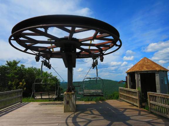
First was the immense bullwheel. We thought we’d stumbled upon an active ski resort but then saw the rust, the mold — and then the teenage boys hanging from the wheel. They were kicking their legs in an effort to make it move.
My mother, god rest her soul, leapt out of my mouth. AHHHH! YOU’RE GOING TO GET YOURSELVES KILLED!
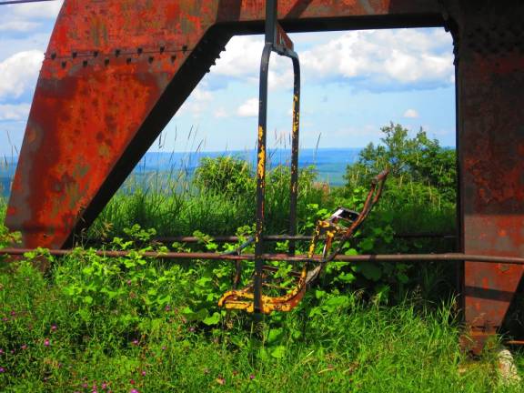
The boys turned languidly in my direction, as if they’d heard a chipmunk squeak. I looked at Tom, a former teenage boy, for confirmation, but he was busy feigning fascination with one of the peeling lift chairs.
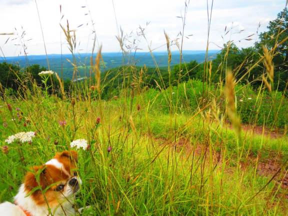
I went digging for my phone. My mother would definitely have called the police! But then I came across our lunch — a good one today, fresh mozz, olives, ciabatta, tomatoes. We realized, all of a sudden, not only that we were hungry, but that were in a field of sun-warmed, late-summer wildflowers — yarrow and clover, Queen Anne’s lace, white asters, and purple thistle.
We sink down among them, like Dorothy and Tin Man among the poppies, and let the fantastical emerald view down the valley cast its spell. The boys’ mortal danger is long forgotten. Like King Henry and Anne Boleyn, we would have made inadequate parents.
SNEAK PEEK
Trail: Bald Mountain (formerly the Scotch Valley Ski Center or Deer Run Ski Center, 1962-98). Blazes appear here and there but are mostly useless.
Trailhead: Archibald Field off Route 10, a few miles outside of Stamford, N.Y.
Miles: 4.5 round-trip loop