All paths lead to the A.T.
When one trail washes out, there’s always another way onto the hiker’s superhighway


We discovered two new climbs to the Appalachian Trail, up to that prickly, spiny rock nougat that makes your fancy hiking boots feel like slipper-socks from the dollar store. We found these trails while avoiding the dysfunctional Old Mine Road, whose widening washouts, craters, and cracks burned up too much daylight. Coming at our intended destination, Tillman Ravine, from from the east instead of the west, we spotted two new-to-us trailheads, about a half-mile apart, where you can start a 500-foot climb to the AT. We eventually hiked both trails, on different days, and got to explore a serene and stunningly beautiful section of Stokes State Forest.
Trail maps sometimes promise attractions that miss the mark. Take Jacobs Ladder, another trail within Stokes whose name is inspired by the ladder to heaven that appeared to the biblical patriarch in a dream. This Jacobs Ladder does not, however, lead to a heavenly viewpoint. Nor does it possess any quality that would elevate it above the many picturesque rock slabs to be found all over the Kittatinnies and beyond. It’s a pretty slab, to be sure, creased by geologic pressures and crossed by tree roots to form a natural step stair. And it does connect both of our newfound trails with the queen of them all — the quartzite crown of the Kittatinnies, the scraper of the New Jersey sky – the everlasting AT.
On our first foray, we hiked the Red Maple Trail 1.75 miles to the Jacobs Ladder Trail. Oaks and hickories, pines and spruces, blueberries and rhododendrons crowd the trail as it winds through a series of drumlins (from the Gaelic for “little ridges”), which lend the forest a Middle-earth vibe. These low oval hills were shaped by the Laurentide Ice Sheet, which left behind the mess of quartz conglomerate that would one day eat my boots. It also left behind these drumlins, whose origins remain mysterious, even to geologists.
Our second hike up the ridge started just past an old wooden sign announcing the Steffen Cross-Country Ski Trail. It immediately rises ridiculously and unceasingly in a way that I prefer my cross-country skiing trails not do. But it’s May, so we’re fine. About a quarter-mile in, two park rangers show us a lady’s slipper orchid blooming just off-trail.
The scene is busier on the AT. It was like stepping into the flight path of a spring migration, both avian and human. Every 10 minutes or so we’d pass a lone northbound hiker, male, eating up the miles under a full pack and a radiant canopy of new spring leaves. Through-hikers up from Georgia, I’ll bet. They usually hit Jersey around June, but, like robins, the fast ones get here early.
The other migrants were of the flying, chirping and roosting kind. The many divas and divos among them had much to get off their feathered chests. I launched my Merlin Bird ID, an app developed by the Cornell School of Ornithology. It announced that it was World Migratory Bird Day! And that all my birds would be recorded as part of this global effort. And what a haul I had, too. In Sandyston, I picked up the American robin, Tennessee warbler, ovenbird, tufted titmouse, blue jay, yellow-throated vireo and red-bellied woodpecker. We stopped again further south, in Newton, after hearing the “Zee-zee-zee-zee-zee-zee-zeeeee!” of the prairie warbler. Another half-mile on, Merlin captured the great-crested flycatcher and the scarlet tanager amid the cacophony.
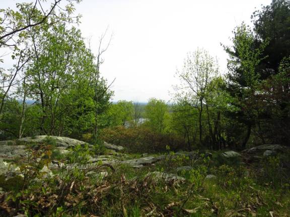
After ascending Jacobs Ladder our first time out, we’d turned right on the AT and headed toward two viewpoints marked on my map. We hadn’t found much. We’d scrounged a view of Lake Owassa through a keyhole formed by the unfurling leaves. Not bad. I’ll bet this view is just fine when the leaves are down.
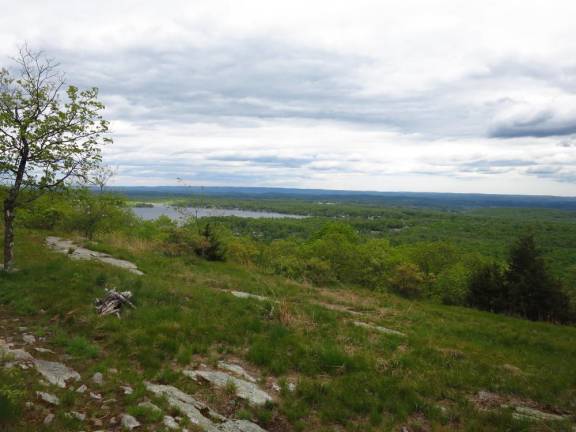
Next time out, we turned left to find a wide-open view overlooking Culver Lake. It’s an ideal spot for a picnic. Do you prefer smooth rock or mountain grass? Sun or shade? We picked grass and sun. A through-hiker was hauling ass right past the view when he spotted us lolling on our grass patch. He paused awkwardly, as if caught in the act of screwing up his priorities.
“Great view!” he said. He lifted his cell phone to take a picture. After a beat he turned back to wave good-bye, phone in hand, before resuming his northward charge.
SNEAK PEAK
Parking for both trails is on Struble Road in Sandyston, N.J.
Steffen Trail parking is a quarter-mile from Rte. 206. The black/gray-blazed trail begins across the street and continues for 1.2 miles. At the four-way intersection, turn left onto an unmarked trail (the old Red Maple Trail), which intersects after a mile with the blue/gray-blazed Jacobs Ladder Trail. Turn left. A quarter-mile climb gets you to the AT. The Culver Lake view is 1.4 miles to the south.
Red Maple Trail parking is .75 miles from Route 206. Park at the Lake Ashroe Recreation Area and follow the red-blazed trail 1.75 miles to the bottom of the blue/gray-blazed Jacobs Ladder Trail. From there a half-mile climb gets you to the AT. The Lake Owassa view is another half-mile-plus to the north.